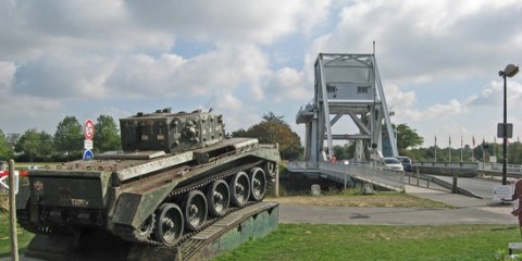
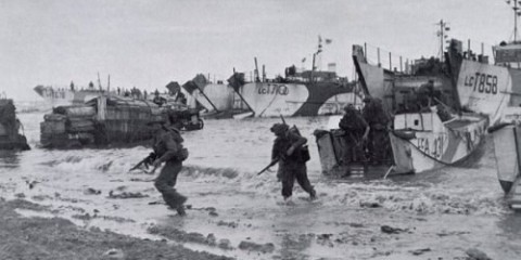
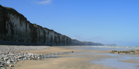
This beach was planned last and is the only situated on the Cotentin (Cherbourg) Peninsula. The landing of the 4th infantry division on this beach is linked with the US paratroopers (101st and 82nd airborne divisions).
Both the Paratrooper Divisions and the 4th Infantry Division were part of the 7th US corps under the command of General Collins.
The main objectives of the 4th division was to link up with the paratroopers, relieve them and then prepare the next phase: pushing west to cut the Cotentin Peninsula and isolate the German defenders of the port of Cherbourg.
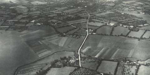
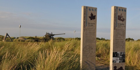
The landscape behind the dunes lining the coast is flat and low-lying and had been permanently flooded by the German defenders.
The German forces here were part of the 709th Infantry Division, a low-quality, static coastal defense unit.
Thanks to the orientation of the beach (north to south), the flat landscape, weak German defenses and also a large piece of luck, the allies took far fewer casualties on Utah Beach than had been anticipated.
What to see:
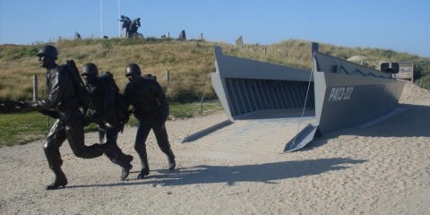
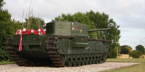
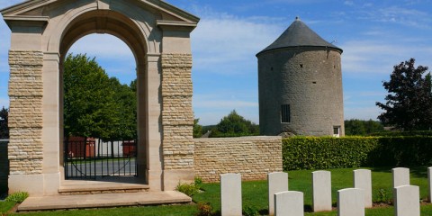
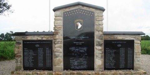
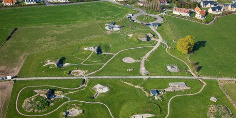
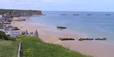
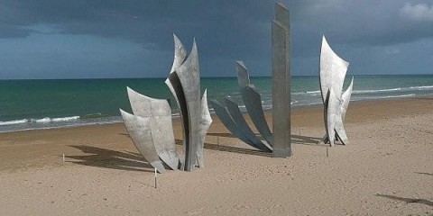
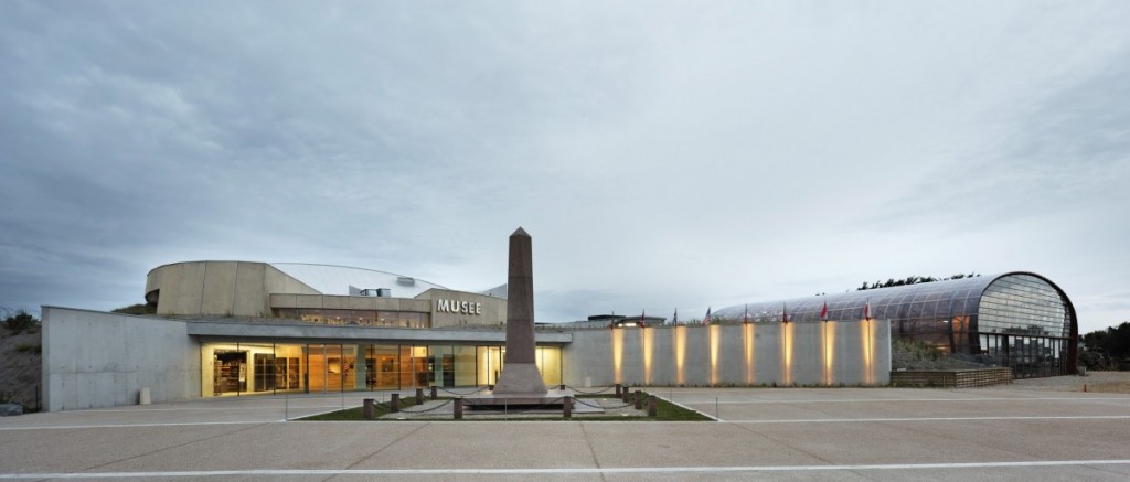
There are many vestiges of the German Defenses left here along with numerous memorials, the most recent being a monument to the sailors of the US Navy. Operation Neptune, the amphibious part of the D-Day Assault was the biggest to date and during the fighting in Normandy in the summer of 1944 eight ships were sunk and 1,068 sailors and Coast Guardsmen died.
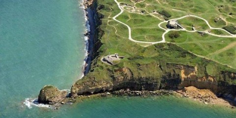
The first bunker assaulted on d-day is now part of the museum dealing with the landing of the 4th US Division.
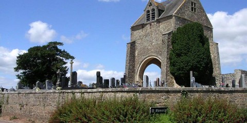
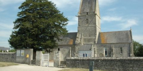
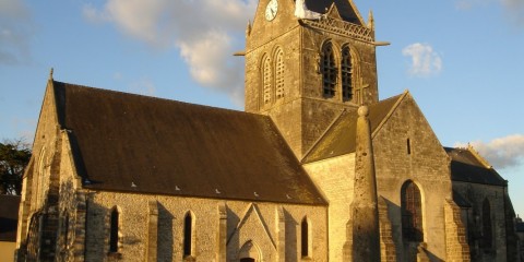
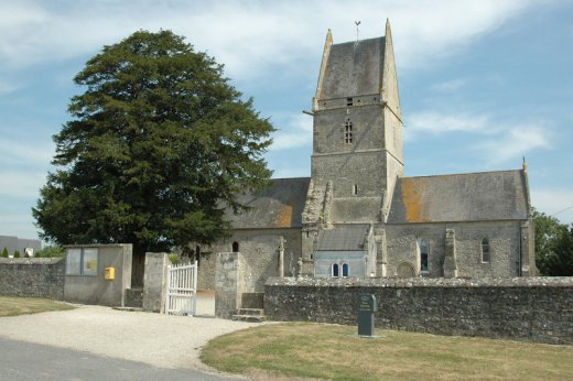
This tiny hamlet was the witness of fierce fighting during several days.
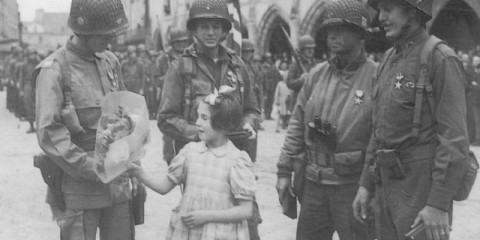
On the first day, 2 American medics from the 101st Airborne division, Kenneth Moore and Robert Wright settled a field hospital in the parish church. They took care of US and German soldiers and a little girl.
Despite the village changed hands several times, both belligerents respected the heaven of Peace.
To see now : The pews that were use as stretchers are still here. New stain glass windows connected to the events of WWII now decorate the church.
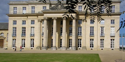
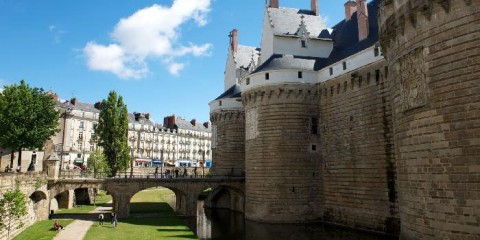
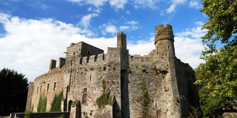
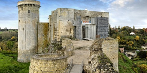
After the Val es Dune battle in 1047, the young duke William imposed to his vassals the “Peace of God”. The main palaces of the Duchy where still in the North and the East of Normandy. In order to control better the Western side of Normandy, he decided to built a castle on the Orne river by a small town of tanners.
Very soon the Duke’s town grew round it. It was later surrounded by ramparts.
After he married Matilda of Flanders against the will of the pope, William had to negotiate his way to heaven. He would avoid excommunication by building 4 hospitals and 2 abbeys.
The 2 monasteries were built in the proximity of the new castle. The 2 monarchs (William and Matilda) are buried in the abbey churches.
Around the Men’s abbey grew the Abbot’s town (also fortified), around the Women’s abbey grew the Abbess’s town.
Once the fortifications became obsolete, the extension of the towns was no longer limited.
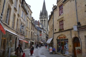
The 3 towns became Caen city.
The medieval city was very badly damaged during the battle of Normandy.
A part of the town remained on fire for 2 weeks after the first air strike on D‘Day.
Fortunately, the main historical buildings survived and the city was rebuilt with the local limestone.
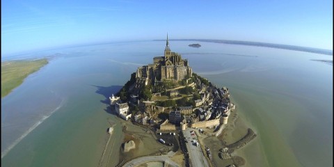
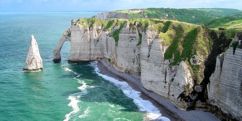
The Mont Saint Michael is situated on the boundary of Normandy and Brittany and runs up to a height of 250 feet overlooking the bay between the two provinces, the bay having the highest and most impressive tides of Europe.
In 708AD, Bishop Aubert of the nearby town of Avranches was visited in a dream by the Archangel Michael and told to build a sanctuary on the top of the mount dedicated to the Archangel.

Thus this large offshore mount was dedicated as a monastic site and turned into a very active site of pilgrimage.
The Abbey, situated at the summit, grew wealthy on the donations of the many pilgrims who came to visit and its architecture and magnificence grew as the centuries passed.
A village sprang up around the Abbey at the base of the mount with strong defensive walls being added later as the site aquired a military strategic importance. On approaching the Mont St Michel today these walls still give a first impression today of a castle floating on the water.
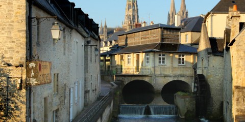
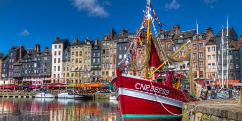
Rouen city was the first capital of Normandy designated as such after the peace treaty which was signed in 911 by Charles the Simple, King of France and Rollo, the Leader of the Vikings who were, at that point, threatening Paris.
Rouen city was the second largest city in the medieval Kingdom of France. It benefited a lot from its position on the Seine River half way between Paris and the Seine estuary, with its port being deep enough for sea-going ships to dock there.
Its woolen industry developed and gradually the town gained more and more wealth and thus more and more independence.
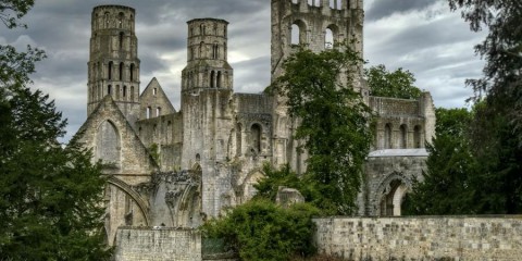
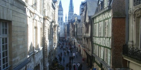
Owing to the number of churches built there the city of Rouen is also known as the city of 100 steeples.
During the Hundred Years War, Rouen city was occupied by the invading English Army for 30 years. It was during this period that Joan of Arc was tried and executed in here. A monument now stands on the site where she was burned to death at the stake for being a witch.
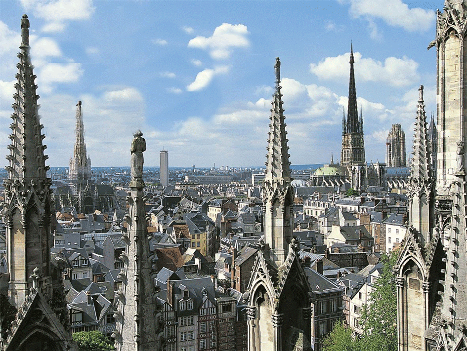
In the 1970’s a church dedicated to Saint Joan of Arc was built nearby. Its modern architecture surrounds stained glass windows dating from the XVth century. These windows were originally made for the church of Saint Vincent in Rouen, but they were removed at the beginning of WWII and hidden in a cave in the Loire Valley. Following the bombing of Rouen during the Second World War the church of Saint Vincent was one of the buildings destroyed, hence the windows today being in an otherwise very modern church. Despite the entire left bank of the Seine River being bombed flat during the Second World War, Rouen today is still filled with magnificent churches including Rouen Cathedral, a building which was painted many times by Claude Monet. A walk along Rouens ancient streets will also allow you to discover the former parliament building of Normandy, the “old clock” with only one hand that once indicated the phase of the moon still showing the day of the week…

Normandy

D’day

D’day

Heritage

Battle of Normandy

Battle of Normandy

Battle of Normandy

Battle of Normandy

Battle of Normandy

Battle of Normandy

D’day

D’day

D’day

D’day

D’day

D’day

D’day

D’day

D’day

D’day

D’day

D’day

D’day

Heritage

Heritage

Heritage

Heritage

Heritage

Heritage

Heritage

Heritage

Heritage

Heritage